Xinjiang
Overview of Xinjiang Uygur Autonomous Region

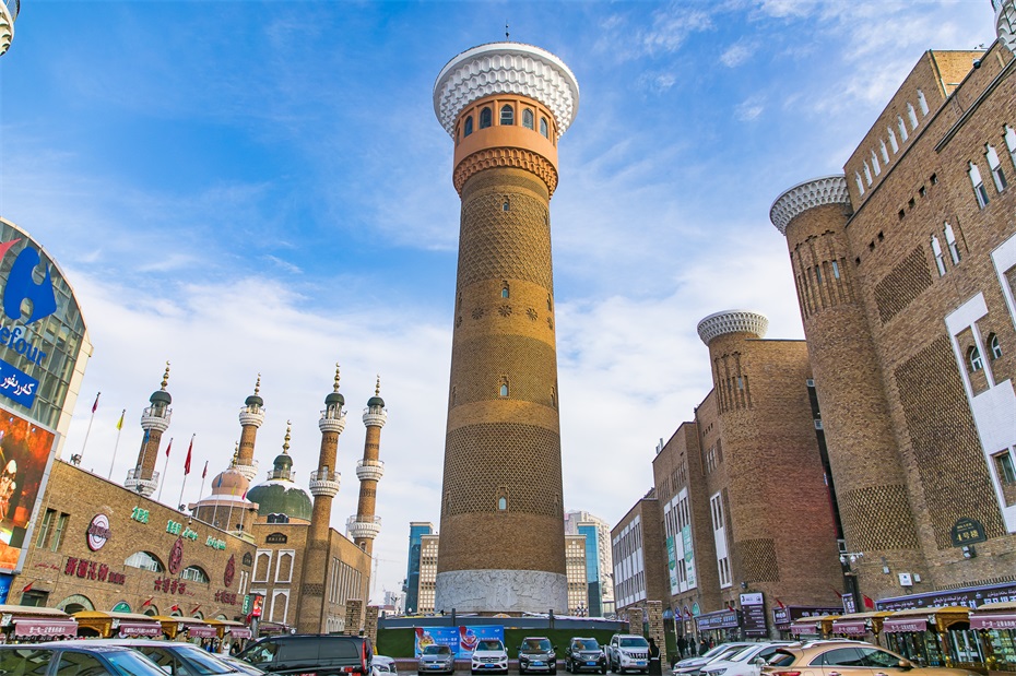
Xinjiang Uygur Autonomous Region, abbreviated as "Xin", is located on the northwest border of China, in the hinterland of the Eurasian continent, and is the largest provincial-level administrative region in China in terms of area. The total area of the district is 1.6649 million square kilometers, accounting for about 1/6 of the total area of the country. It has 14 prefectures and cities under its jurisdiction, with a permanent population of 25.87 million people (2022 data). In 2022, the gross domestic product of the entire region will reach 1.77 trillion yuan, making it an important energy base, agricultural base, and gateway to opening up to the west in China.
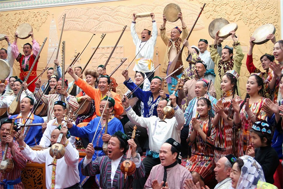
Xinjiang now governs four prefecture level cities, namely Urumqi (capital), Karamay, Turpan and Hami, five autonomous prefectures, namely Changji Hui Autonomous Prefecture, Bortala Mongolian Autonomous Prefecture, Bayingolin Mongolian Autonomous Prefecture, Kizilsu Kirgiz Autonomous Prefecture, Ili Kazak Autonomous Prefecture, and five regions, namely Aksu, Kashi, Hotan, Tacheng and Altay. As an important channel of the ancient Silk Road, Xinjiang is known as the "Hometown of Singing and Dancing", "Hometown of Melons and Fruits", "Land of Gold and Jade", and the core area of the "the Belt and Road" construction.
2¡¢ Geographical features
1. Location characteristics
Xinjiang is located between 34 ¡ã 22 ¡ä -49 ¡ã 10 ¡ä N latitude and 73 ¡ã 40 ¡ä -96 ¡ã 18 ¡ä E longitude. It borders Mongolia to the northeast, Russia, Kazakhstan, Kyrgyzstan, and Tajikistan to the northwest, and Afghanistan, Pakistan, and India to the southwest. Its border is over 5700 kilometers long, making it the province with the longest border and the most neighboring countries in China.
2. Terrain and landforms
The terrain of the entire region presents a pattern of "three mountains sandwiching two basins":
North: Altay Mount Taishan
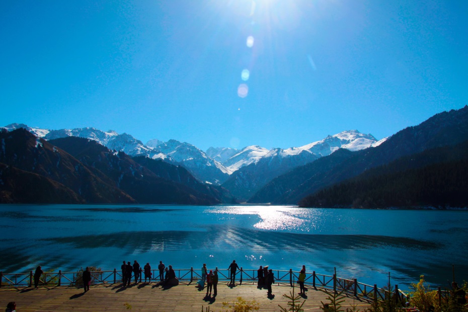
Central region: Tianshan Mountains (dividing Xinjiang into two parts, north and south)
Southern region: Kunlun Mountains
The Junggar Basin (Northern Xinjiang)
Tarim Basin (southern Xinjiang)
Lowest point: Turpan Aiding Lake (elevation -154 meters)
3. Water system distribution
Neiliu River: Tarim River (the longest Neiliu River in China)
Outward river: Ertix River (flowing into the Arctic Ocean)
Lakes: Bosten Lake, Selim Lake, Kanas Lake
Glaciers: Modern glaciers in Tianshan and Kunlun Mountains
4. Climate characteristics
Belonging to temperate continental arid climate:
Annual average temperature: 4-14 ¡æ
Annual precipitation: 50-200 millimeters
Significant features: sufficient sunshine, large temperature difference between day and night, drought and little rainfall
3¡¢ Historical context
1. Origin of Civilization
Bronze Age: Xiaohe Cemetery (4000 years ago)
Before the Han Dynasty: the period of the Thirty Six Kingdoms in the Western Regions
Han Dynasty: Zhang Qian traveled to the Western Regions and opened the Silk Road
2. Organizational history
Han Dynasty: Establishment of the Western Regions Protectorate (60 BC)
Tang Dynasty: Protectorate of Anxi and Beiting
Qing Dynasty: Establishment of Xinjiang Province (1884)
1955: Xinjiang Uyghur Autonomous Region was established
3. Ethnic integration
Uyghur: the main ethnic group that has lived for generations
Han ethnicity: Throughout history, there have been settlements, reclamation, and border defense
Kazakh: a nomadic ethnic group
Other ethnic minorities: 47 ethnic groups including Hui, Kyrgyz, etc
4¡¢ Cultural Essence
1. Multicultural characteristics
Oasis Culture: Silk Road Commercial Civilization
Grassland Culture: Traditions of Nomadic Peoples
Military Reclamation Culture: Pioneering Spirit of the Corps
Religious Culture: Coexistence of Multiple Religions
2. Intangible Cultural Heritage

Folk art: Adles silk weaving and dyeing, Hetian jade carving
Traditional skills: Uyghur molding method for pottery and mulberry paper production
Folk Culture: Maixirefu, Nadam Conference
3. Language and Writing
Uyghur language: the common language of the autonomous region
Chinese: the national common language
Minority languages such as Kazakh and Kyrgyz
Coexistence and use of multiple languages
5¡¢ Tourist destinations
1. World Heritage Sites

Silk Road: Chang'an Tianshan Corridor (Xinjiang section)
2. 5A level scenic spot
Kanas Scenic Area
Tianshan Tianchi Scenic Area
Turpan Grape Valley Scenic Area
Narati Tourist Scenic Area
Keketuohai Scenic Area
3. Featured tourism
Silk Road Cultural Tour: Gaochang Ancient City, Jiaohe Ancient City
Natural scenery tour: Kanas, Lake Selim
Folk Experience Tour: Kashgar Ancient City, Hemu Village
Ice and Snow Sports Tour: Altay's "Origin of Human Skiing"
6¡¢ Food map
1. Xinjiang's characteristic cuisine

Saute Spicy Chicken
Hand pilaf
Rou wrapped in naan
2. Featured snacks
Mutton shashlik
Xinjiang noodles
samsa
yogurt
a kind of crusty pancake
3. Specialty drinks
Hami Melon
Raisins
Korla pear
Hotan jujube
Yilite liquor
7¡¢ Development Status
1. Industrial system
Energy industry: oil and gas, coal, wind and solar power
Modern Agriculture: Cotton, Forestry and Fruit, Livestock
Tourism Industry: Comprehensive Tourism Demonstration Zone
Textile and Clothing: Undertaking the Transfer of Eastern Industries
2. Transportation network
Aviation: Urumqi Diwobao International Airport
Railway: Lanxin High speed Railway, Southern Xinjiang Railway
Highway: The mileage of expressways exceeds 7000 kilometers
Pipeline: Starting point of West East Gas Pipeline
3. Open platform
China Eurasia Expo
Core area of the Silk Road Economic Belt
Kashi and Khorgos Economic Development Zone
Cross border E-commerce Comprehensive Pilot Zone
From Tianshan Snow Peak to Taklimakan Desert, from Kanas Lake to Turpan Basin, this "vast territory" is writing a magnificent chapter of Xinjiang's development in the new era with the "Populus euphratica spirit" and the "Corps spirit". There is both the magnificence of the "desert smoke straight" and the splendor of the "hometown of singing and dancing", which is becoming an important window to show the progress of China's national unity and the achievements of the "the Belt and Road" construction.
simliy
